Here you will find web mapping applications displaying information relevant to the work of the Regional Planning Commission
Project Locator

The Land Subdivision Committee of the Springfield-Sangamon County Regional Planning Commission reviews subdivision related items for the City of Springfield and Unincorporated Sangamon County. This application will allow the public to track the progress of a development through the subdivision process. This map is for informational purposes only and the SSCRPC does not guarantee the accuracy of the map.
Demographic Fast Facts

This application was developed by the Springfield-Sangamon County Regional Planning Commission to provide easy access to demographic information for Sangamon County and each of its municipalities.
Sangamon County Parcel Viewer
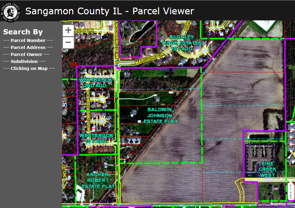
Parcel Viewer for Sangamon County. Access parcel information and maps via desktop browser, tablet or mobile device.
Biking Springfield

This application displays existing bikeable routes and amenities throughout Springfield and surrounding area.
Springfield Area Transportation Study (SATS) Functional Classification
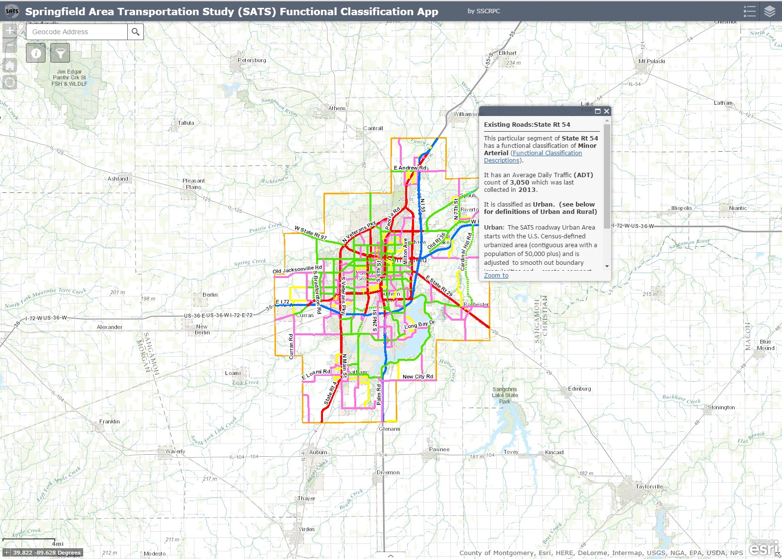
The Springfield Area Transportation Study (SATS) assigns a functional classification to each road in the SATS planning area based on guidance from the Federal Highway Administration (FHWA). This map provides information for roadways classified as collectors, arterials, and interstates.
Hourly Public Parking in Downtown Springfield
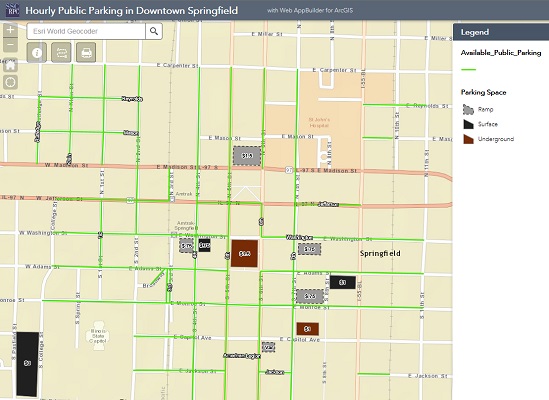
The Hourly Public Parking in Downtown Springfield app provides information on location of public parking and cost of parking ramps and lots in Springfield's wonderful downtown area. If you are curious to know the most ideal location to park in downtown, this app is perfect for you.
Bicycle Parking Racks in Downtown Springfield
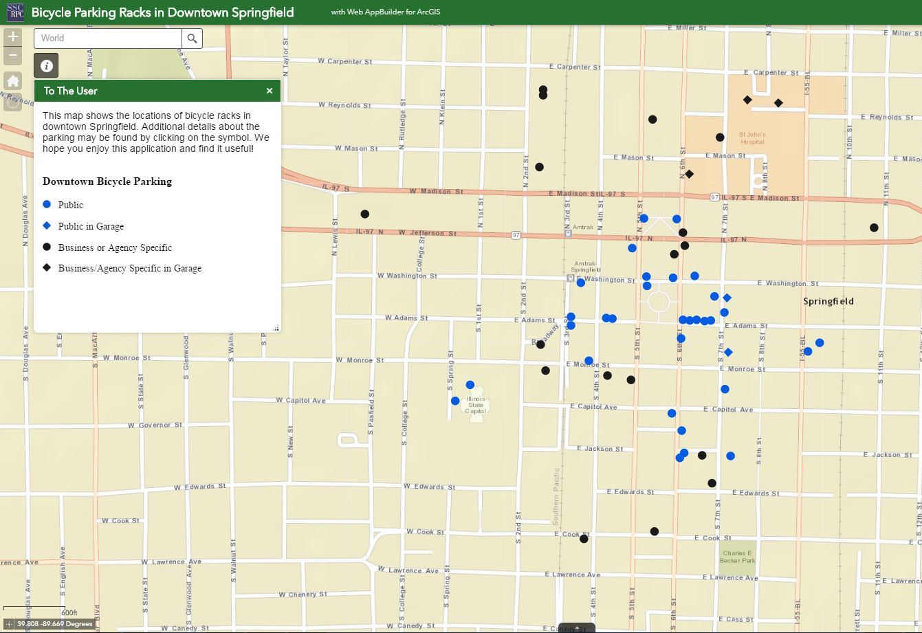
This application shows a map of downtown bicycle parking and racks for the general public, as well as for businesses and agencies that provide a public accommodation. If you’ve ever wondered where you can lock up your bike in downtown Springfield, this app is for you.
Springfield Mass Transit District Access Springfield

Access Springfield provides origin-to-destination transportation for persons with disabilities who are unable to use the SMTD fixed-route bus service. This map shows the Access Springfield boundary to assist in determining if origins or destinations are within the Access Springfield service area.
Envision Bicycle Network
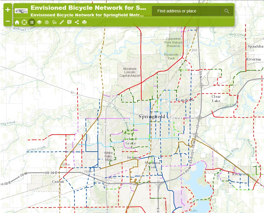
The Envisioned Bicycle Network (EBN) envisions the Springfield Metropolitan Planning Area as a place with interconnected networks of safe and efficient bicycle ways that link bicyclists to jobs, stores, services, schools, recreation facilities, tourist attractions, social events, and the mass transit system and that also provide opportunities for recreation and exercise. This network is supported with amenities and safety features and its users are respected and integrated into the fabric of the transportation system. Development of this network enhances livability, health, welfare, and economic vitality in our communities, leading to a higher quality of life for all.
Sangamon County Trails Amenities
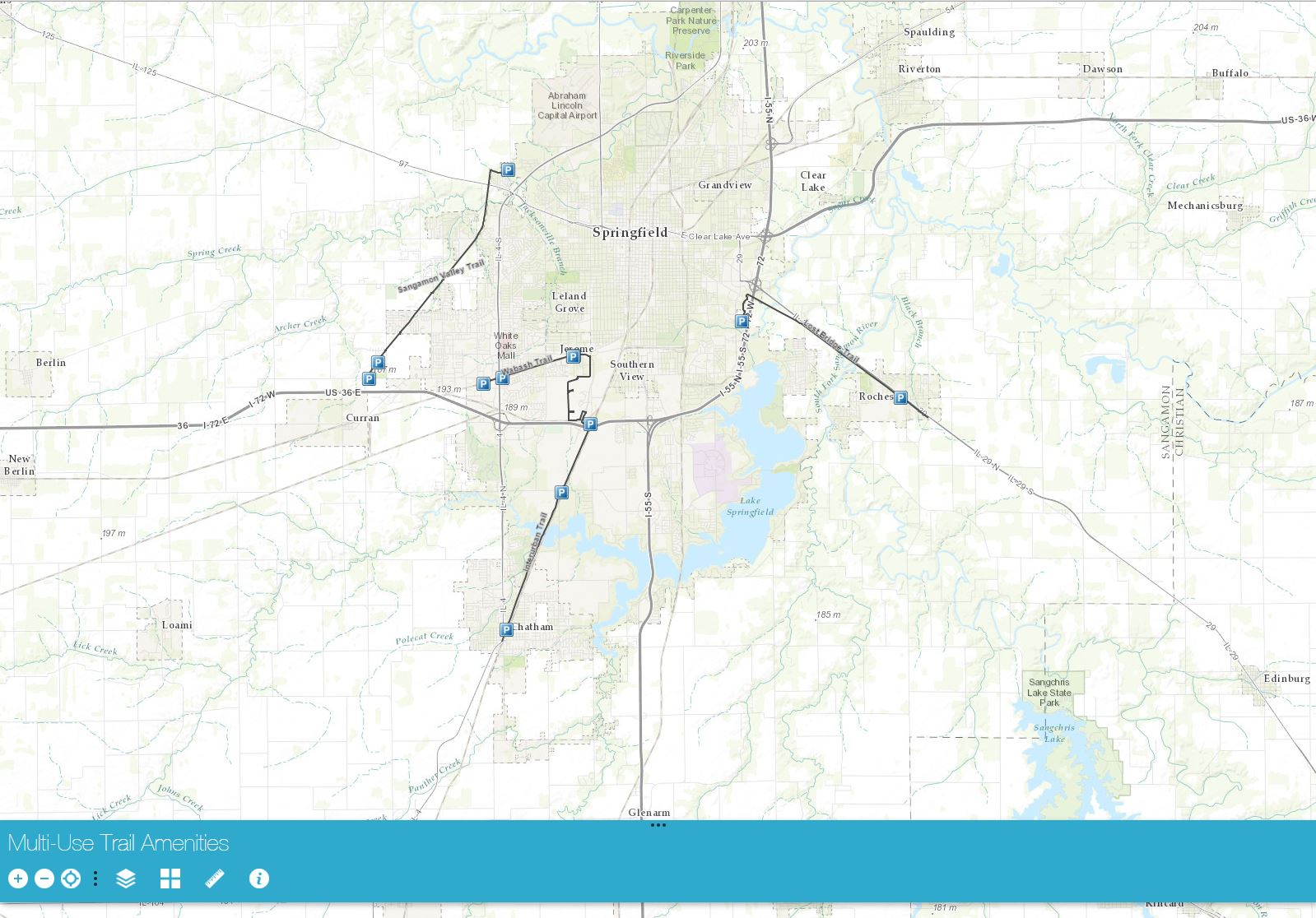
Heading out to enjoy the trails? Take this map with you to help locate amenities along the trail. Find parking, bike repair stations, picnic areas and more using this convenient map.
Route 66 Bicycle Trail Through Sangamon County Illinois
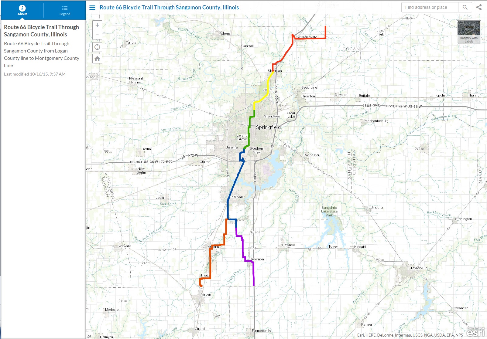
Route 66 Bicycle Trail through Sangamon County from the Logan County Line on the north to the Montgomery County Line on the south via Divernon. This includes an optional segment from the Covered Bridge Rd through Auburn to the Montgomery County Line. Each Trail segment includes a short video of the route. Please click here to view the application.
Sangamon County Zoning Interactive Web Application
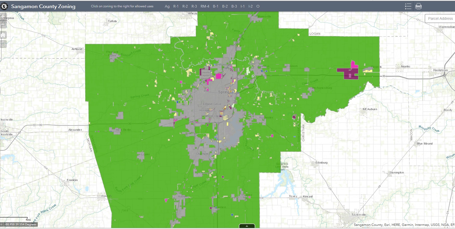
The Sangamon County Zoning Department and the Springfield-Sangamon County Regional Planning Commission hereby disclaim any and all liability or responsibility for any damage, injury, loss, claim or lawsuit arising from any error, inaccuracy or problems with the data contained on this document, the digital media it was produced from, or the digital media itself. This map is intended for illustrative purposes only; contact the Sangamon County Zoning Administrator at 217-753-6760 to obtain the official zoning classification for your property. This map does not reflect any conditional permitted uses or use variances.
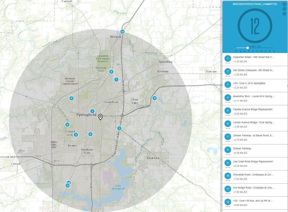
SATS 2040 Long Range Transportation Plan: Committed Project Status
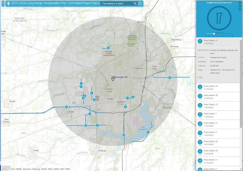
This application identifies projects from the Committed Projects list of the Springfield Area Transportation Study's (SATS) 2040 Long Range Transportation Plan (LRTP). These projects are anticipated to begin within the first five years (2015-2019) of the LRTP. The phase, description, cost, and status of the projects are identified within the application.
Using the Application
- Input an address at the top of the page
- Slide the bar to adjust your radius (default is 10 miles)
- Use the arrows - top right corner of page to toggle between Road and Bridge Projects
Landmarks and Selected Historic Resources
This app allows the user to access information about landmarks and other selected historic resources from various devices. It requires input of an address to access the list of local landmarks and selected historic resources.
This map is for informational purposes only and the SSCRPC does not guarantee the accuracy of the map.
Neighborhood Associations
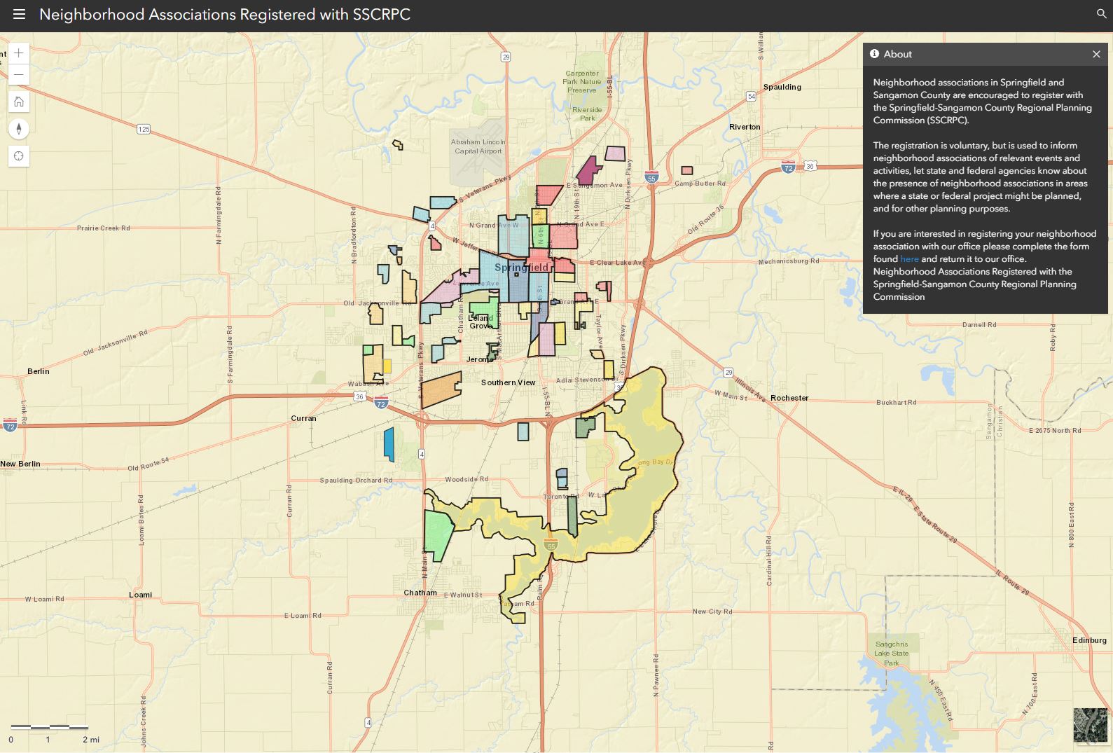
Neighborhood associations in Springfield-Sangamon County are encouraged to register with the Springfield-Sangamon County Regional Planning Commission. Register by completing and returning this form to our office.
This map is for informational purposes only and the SSCRPC does not guarantee the accuracy of the map.
Natural Areas Inventory
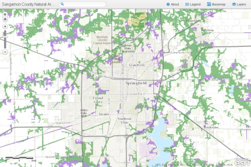
The Natural Areas Inventory was prepared in 2004 to show the quality and the location of natural areas in Sangamon County. This application allows the public to view the natural areas documented in the report.
Springfield Central Business District Inventory Project Beta
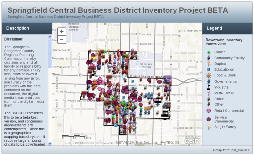
The Springfield-Sangamon County Regional Planning Commission hereby disclaims any and all liability or responsibility for any damage, injury, loss, claim or lawsuit arising from any error, inaccuracy or the problems with the data contained on this document, the digital media it was produced from, or the digital media itself.
The SSCRPC considers this to be a beta-test version, and continuous improvements are contemplated. Since this is a geographical mapping based system, it requires large amounts of data to be downloaded for each user inquiry. The speed at which it responds will be affected by the speed of the user's internet connection, the browser being used, and the speed of the user's computer.
By clicking "I Accept" you agree to these terms and will be directed to a map of the data.
I Accept
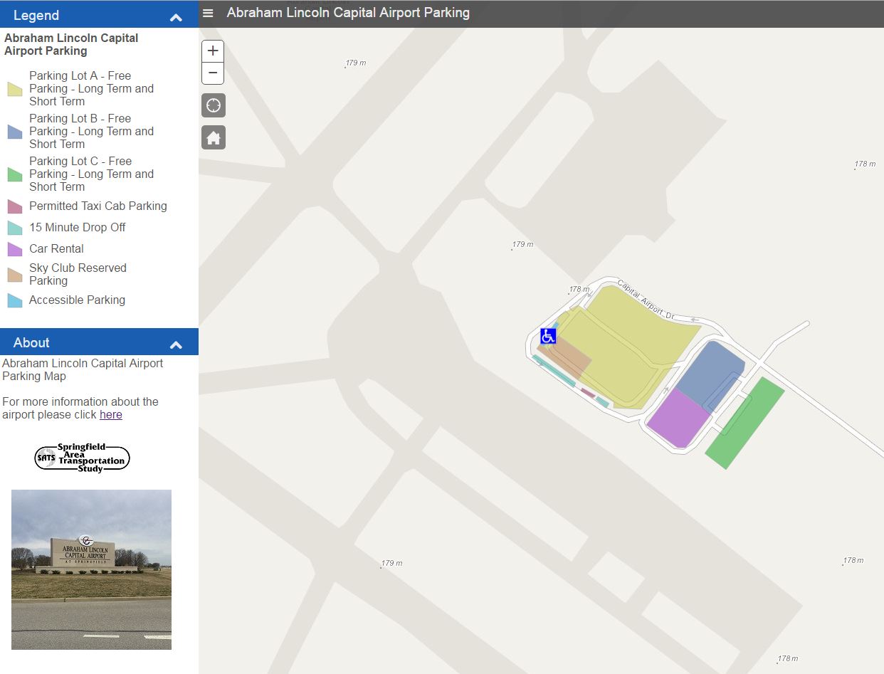
Abraham Lincoln Capital Airport Parking
Contacts
Please direct any web mapping related questions or comments to Joe Zeibert.